 |
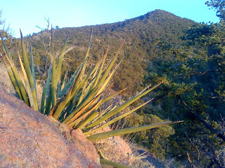
| The pointy cap of Picacho |
 |
| Looking faded on the top |
Right, so I hadn't been up this way in a while and we like to add variety to our outings so off (and up) we went. I don't run Picacho much and here's why: It's steep as hell and it's an out-and-back. Two miles of un-relenting climbing above Santa Fe Canyon, followed by two miles of steep descent. Great views of Atalaya though, and if you have the time you can link them both up (think Dale Ball Buster). You may be training for a hill climb - say, La Luz - in which case the trail up Picacho is is tailor made just for you. If this is in fact the case, know that you can tack on an extra 2+ miles and 400ft of climbing by starting your run at the Upper Canyon Rd/Cerro Gordo Trailhead (think Dale Ball Buster). The direct ascent from Upper Canyon is the longest steepest percentage grade trail climb in Santa Fe.
Tough going, but open and accessible unlike many of our surrounding trails. Out and back on our route mapped below is just four miles (28min climb, 23min descent). Several variations are available at mapped junctions.
 |
| The north Atalaya ridge to the east, summit at right |
 |
| Atalaya Peak looking south |
 |
| Picacho summit stones with the Santa Fe Watershed at middle and the Sangres in the distance |
Picacho: Spanish for 'top, or summit; sharp point of anything'
Distance: 4mi roundtrip
Elevation at Upper Atalaya trailhead: 7450ft
Picacho Summit: 8577ft
Nearby Trails:
View Picacho Peak - Santa Fe, NM in a larger map
I hope the trails are back open for you. I've run up Atalaya, down the backside and over to Picaccho then Dorothy Stewart a few times. You have some really awesome stuff nearby for sure.
ReplyDeleteYes we do. Although I see the brilliant photos of the hills around Durango and wonder why I don't travel up there more often. You all have beer, right? (I kid, i kid).
ReplyDeleteThe trails are open here now that the July monsoons have brought several inches of needed rain. So much rain we're now trying to manage the washouts and flooding problems. Feast or famine I tell ya.