Showing posts with label Trails. Show all posts

Wednesday, November 29, 2023

New Area Trails - Santa Fe

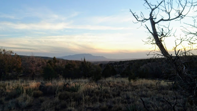
Shaggy Peak Overlook 

...[we're gonna just roll on back like we never left]...

Been a fair amount of new terrain popping up the last several years. Most of it planned and permitted, some of it rogue. All the new pathways are lovely and well built, with an eye toward graceful bends and loops as well as shedding water. 

I could choose to write about the best one but I won't because few seem to know about it just yet and I kinda prefer it that way. Instead I'll note the new tracks south of the Santa Fe Watershed, up Forest Rd 79, through the village of Canada de Los Alamos. The drive is shorter than to Galisteo, Glorieta, or Pecos, though the road and wayfinding are more difficult (vehicles with clearance recommended). 

The really keen thing about this area is its isolation. It just won't be the first choice for most (or 2nd or 3rd) to seek out mileage or a weekend ride, certainly not for visitors due to navigational challenges, and similarly unlikely for runners or most hikers due to its distance from town and lack of a creek or water way. A note to always assume that quiet places like this are beyond cell reception, which is mostly true here except on high points and along some ridgelines. 

fucking run away

The Forest Service worked with a few local outdoors groups to lay down 4mi of new trail. Some of this connects and runs along decades-old access and wood cutting roads, to the east the network will connect down and into Apache Canyon. Sorta fun and dramatic until you have to haul yourself and your rig outta there. While the isolation can be rather peaceful it also can get uncomfortable if you lose your bearings or find that you're turned around somehow. Just has a different feel than the Winsor watershed - best illustrated by the ghost house which I came upon on maybe my third exploration of the area. Nothing spooky or demonic-adjacent here, nope. Curiosity drew me closer to inspect - because WTF? - however I found it to be just one of those places with dark unhappy vibes and I set to mashing pedals to quickly get the fuck outta there.

As so often happens, I scurried directly up what happened to be a leg-bursting ravine ascent. All hexes and cursed intentions confirmed. Should you find yourself at the top of cursed ascent, you'll want to bear to rider's right for a bit more hike-a-bike but also a linkup to a winding (new) mile descent of singletrack which is really first rate stuff.

Cursed Ascent

Riding options generally run north-south from the main parking(ish) area. There's not a good way to describe this since nothing is signed but you head up the FS 79 for a few miles (~15min from the forest service gate/signage) and this is just beyond the second of two wood-cut access roads on the right. Trail runs along and below the east side of the road. Bien aventuras perdidas. 

Saturday, August 24, 2019

Carpenter's Pikes Peak Record May Fall

Carpenter - in the switchbacks near the summit
It's Pikes Peak weekend - not that I'll be in Manitou Springs to run. Pikes is a crazy race and it is the trail running test piece in the central rockies. Steve Gachupin and Senovio Torres made names for themselves on that climb and held the age-group records for years until Matt Carpenter showed up and cleared the board. His top mark, un-threatened now for more than 25yrs, is 3hr 16.5min.

This weekend spaniard Kilian Jornet plans to be on the line for Sunday's marathon to challenge this storied mark and hoist his name to the top. Running friends in Colorado have been discussing this topic for weeks, a serious record attempt by a champion runner, this could go. Jornet is the toughest trail runner the world has seen though he generally specializes in grueling all-day distances and technical courses at high degrees of difficulty. Pikes Peak is relatively short and manicured in comparison (26mi w/ 7.6K of climbing and descent).

The biggest hurdle in a race this short will be familiarity with the trail and whether he can piece together the footing sequences on the ascent to match Carpenter's turn-around time. The top runners will wire these tight sections to memory then surge through during the race to break their chasers. It will be equally necessary for a serious run at the record. Seems very silly to cast doubt on Jornet but I just don't think he can match peak-Carpenter on the climb, I do think he can get it done somehow with a screaming descent, perhaps strong enough to nick 10-20sec from the standard. All very exciting for a niche event that has seen some of the best come and go and gotten nowhere close to Carpenter's mastery of this climb. Toughest trail record their is.


Related Posts:
 - The Tough Guy List
 - Pikes Ascent - Race Report


Wednesday, December 26, 2018

South Mesa - Bandelier National Monument

The climb to the rim from Frijoles
The snow and cold may have finally arrived this morning. Not the case the previous two weeks however which provided optimal time to hit the difficult to reach trails. My favorite, and in my opinion the most underrated trails in the area, are at Bandelier.

I generally sneak in the back at Ponderosa campground. This is because I'm cheap when getting out for a run and don't care to fork-up the $25 gate fee. However I hadn't been out in the canyons for some time and Ponderosa and upper Frijoles were nuked by the Las Conchas fire and after repeat visits it can be bleak. The visitor's center and south mesa are still forested and serene so I hit it up last weekend while still free of ice and snow.

I intended to run out to the rim of Alamo Canyon, but didn't bring a map with me and made a fateful left turn that instead brought me out toward the Rio Grande canyon. Still beautiful, and new trails are always a fun adventure, but the ups and downs of fording the easy to navigate Lummis canyon were missed as was the awe of staring down into Alamo (800ft).

On the trail there was a single pair of hiking tracks which ceased after a couple miles. Still lots of tracks though all were wildlife (!), primarily deer and coyote. Saw an anthill made almost entirely of quartz crystals which fascinated me enough for a closer inspection. On a couple of rest stops to tie my shoe I was astonished to find that the mesa that evening was soundless. Without sound. I could stand there and look around at mountains and canyons and sunset and though craning my neck a bit there was not the smallest mote of movement or sound. After 15-20sec this odd absence would actually begin to bother me and I'd run on, stopping later to confirm that it was not a trick of the imagination. The Caja del Rio drew fairly close, maybe two miles direct, however the yawning Rio Grande canyon loomed below and between. Seems the trail likely descends a break in the mesa down to water's edge at some distant point. At my turn around (45min) the canyon had aligned with my line-of-sight and stretched far to the west with a glint of the pool at Cochiti dam reflecting sparks of white with the fading sun.

The Sandia uplift and Rio Grande canyon at center. Does not convey how sharp this view looks in person.

Snow on the San Miguels, juniper, cloud, and sunset
Note (12/26): The Monument is closed during the current government shutdown. I'd imagine there's access at Ponderosa and Frey Mesa. Perhaps Upper Frijoles off FR 289. The current snowstorm may make this a moot point for the next several days in any case.

Trail map, lower Alamo Trail: Bandelier Natl Mnmt < https://www.strava.com/activities/2021098426 >

Related Posts:
 - Bandelier Celebrates 99 Years (Feb 2015)
 - Bandelier and Lummis Canyon (Apr 2012)
 - Frijoles Canyon in Recovery (Apr 2012)


Monday, January 15, 2018

2018 New Mexico Outdoors Calendar

West Rim Trail
The calendar has flipped and the 2018 Event & Outdoors Calendar has now been brought up-to-date (see Tab at page top^). Most of the year's early season events have been pushed back in hopes of snow, we'll see if the storms are late to arrive or pass us by.

The U.S. Indoor Track & Field Championships is back for another go at the Abq Convention Center. Love this event so much. One season-changer finds the fledgling Outside Bike & Brew event here in Santa Fe jumping from May into early September.

Big additions to the calendar or events that have ceased operations? None that come directly to mind. Announcements or listings welcome at highdesertdirt at gmail dot com.


Related Posts:
 - 2018 Outdoors Calendar
 - 2017 Outdoors Calendar
 - 2016 Outdoors Calendar
 - 2015 Outdoors Calendar
 - 2013/2014 Outdoors Calendar

Wednesday, November 29, 2017

The Nascent Rio Grande Trail Project

In an effort to design and build-out a statewide recreation trail with the vision and function of similar trails in neighboring states - i.e. The Colorado Trail, The Arizona Trail, Continental Divide Trail - state lawmakers established a Rio Grande Trail commission during the 2015 legislative session. The broad outline here would be for a multi-purpose rec trail running north-south along the Rio from Colorado to Texas.

There's a lot of private holdings in this alignment as well as significant Pueblo land throughout the valley so the expectation I'm guessing is that this will be a decades long effort which will likely have several gaps among long sections of contiguous trail over public land. This would still be a very favorable outcome compared with current status. The project also adjoins state and county resources to the small volunteer groups that build trail (generally mtb riders and hikers).

Currently there's a block of federal funding directed toward gathering public opinion, rec-user preferences, and other ideas for how people envision use of such a trail system as well as stuff that would add or detract from the trail experience. A very cool website has been setup for this purpose, a Virtual Open House, where you can read more about the RGT big picture and contribute your own ideas and opinion toward what this thing ought to look like. The ending date is December 11th.

Go there and add your voice to this beauty of a project.
Rio Grande Trail - Virtual Open House (until Dec 11, 2017)


Related Posts:
 - West Rim Trail - Taos, NM
 - Acequia Trail Underpass Groundbreaking
 - Bandelier National Monument and Lummis Canyon

Saturday, February 4, 2017

West Rim Trail - Taos, NM

Taos Gorge Bridge
We spent our Thanksgiving in Taos this November, a marvelous place to be for a few days and it generally helps us rest and re-set for the chaotically busy month of December. Terrific museums and restaurants for such a small town (recommended: The Love Apple, Blumenschein, Fechin House), plenty of trails and wide open spaces.

I got out for a few miles on the West Rim Trail. Views are really something out there, unparalleled honestly. The trail itself is decent though wouldn't have near the draw without the dramatic scenery. Big crowds and groups of people near the Taos Gorge Bridge which then thin out abruptly to maybe a half dozen hikers strung out over the remaining miles of trail. The full layout stretches 9.5mi one way ending near the Orilla Verde Rec Area, by Pilar.

It just so happened that I had been reading of the Rocky Mountain Sheep herds in the Gorge. Two herds were introduced in 2006-2007 and have been growing and doing quite well for themselves, no small feat in a very challenging state to grow wildlife stock. I knew nothing of this until reading of it, and you know, this is great news. Made me happy. I then saw a few dozen of the animals grazing the east rim during my run which was all very exciting as one can imagine. They were bunched right along the rim's edge and I made an attempt to take pictures though my photos didn't quite capture the moment.

The Gorge looking south
Another Taos favorite of mine is the Devisidero Trail which is set southeast of town near Ranchos de Taos. A 5-6 mile loop, though very steep with a similar profile to the summit of Atalaya Mountain. Just across the road from the Devisidero trailhead there's access to the famed South Boundary Trail.  


Above: The view looking east, Pueblo Peak and the white cap of Wheeler. There's sheep over there on the canyon rim eating their weeds but you'll have to take me at my word since they don't show up in the photo. Click thru for a larger image.


Related Posts:
 - Wheeler Peak, Taos NM
 - Additions to New Mexico's Wilderness: Columbine-Hondo
 - Enchanted Forest Ski Trails - Red River, NM


Thursday, December 31, 2015

Local Outdoor Charitable Organizations Need Your Support

Galisteo Basin Preserve
End of the year has arrived, a good time to take inventory of what has passed and what can be improved upon. I'm big on the many outdoor gems we have in and around town and the organizations that make them work. Toward year end (this year it happens to be the final day), I like to highlight these groups, what they do, and how to help them improve and do more.

All the below are northern New Mexico tax-exempt 501(c)(3) organizations, meaning they depend heavily on public interest, volunteers, and contributed dollars. They're also great places to find rad people with shared interests; writers, photographers, conservationists, cyclists, CPAs. The 501(c)(3) designation also means that a contribution made today is eligible for a current year tax deduction and can likewise be accepted tomorrow, monthly, or any random day throughout the year on behalf of general do-gooderness and a sense of building one's community.

The two organizations that (far and away) provide the most improvements and volunteer days on our trails are The Santa Fe Trails Alliance (the volunteer arm of The Santa Fe Conservation Trust), and The Santa Fe Fat Tire Society. Both terrific groups that could use a Saturday of your time as well as your financial support. In a joint effort over the last two summers, these two groups along with the Santa Fe National Forest Service have installed at least five new bridges recently along the Winsor Creek. If you've used a trail in the Santa Fe area over the last 20 years (Rail Trail, Dale Ball, Arroyo Hondo), The Conservation Trust is who you want to give thanks and appreciation. The Commonweal Conservancy manages the trail system out at Galisteo Basin Preserve, and has been fundraising this year for support of the ongoing work at GBP.
SFCT and the Trails Alliance - Since 1993

As far as the running community and support for running programs and events in and around Santa Fe, the most active organizations are the Santa Fe Striders, Girls on the Run, and WINGS of America. Most of the overflow revenue generated by the Striders is directed to the latter two organizations so you might consider just contributing to them directly.

The Santa Fe Watershed Association has taken an active role in beautifying the Santa Fe River and in turn the Santa Fe River Trail which now includes several miles of trail with more planned for next year.

SFFTS - Since 2011

All of these organizations are setup to accept funds electronically via the links below. I'm certain they accept checks by mail or in person too. Make it a resolution for the new year to be part of a trail build workday, attend a planning meeting, or take a minute now to give one of these organizations a boost and do your part to support the outdoors in Santa Fe and northern New Mexico:


  1. Santa Fe Girls on the Run
  2. Santa Fe Trails Alliance and The Santa Fe Conservation Trust
       (also supported by the Banff Film Festival; La Tierra Torture, XTERRA Glorieta, 2nd Street Brewery)
  3. Santa Fe Fat Tire Society (via membership)
  4. The Commonweal Conservancy
  5. WINGS of America
  6. Santa Fe Watershed Association (manages the SF River Greenway)
  7. The Santa Fe Striders (via the button below)

Related Posts:
 - Drink Beer - Support Local Trails (and the SFCT)
 - Local Trail Improvement Updates - New Tab!
 - Trail Improvements to Winsor and Galisteo Basin


Monday, September 7, 2015

Santa Fe Rail Trail Improvements - Updated

Kid is my co-pilot
The Rail Trail’s transformation from footpath to transportation infrastructure appears to be moving along. Phases two and three of the recent engineering improvements, a five mile section from the Spur Trail to Nine Mile Rd then on to Avenida Vista Grande in Eldorado, are just now nearing the end of nine months of work. The most notable addition is the new trailhead at Nine-Mile Rd including a built-out underpass of the tracks. Many of the previously straight sections along the trail now curl and meander through trees. I'm a fan.

The trail has been undergoing re-alignment, re-surfacing, and erosion protection over the last several years, all part of a long-term effort of the NM Dept of Transportation who manages the railroad easements in partnership with Santa Fe County and SFCounty Open Space who manage the trail. The first improvement phase from Rabbit Rd to the Spur Trail (~1.5mi) was completed in 2013. Parking and trailhead reconstruction went in the year before that. There's another three phases of trail work planned out to the junction with Highway 285. Phase four would complete improvements through Eldorado. The last two miles of the rail into Lamy are privately owned and no trail exists there. Funding for this long term trail work sources from county gross receipt taxes and federal highway administration grants.


The new alignment at Nine-Mile Rd, passes under the trestle
From Nine-Mile down to the trestle
New erosion armoring

Sunflowers and meanders
Realignment and clouds

Related Posts:


View Santa Fe Rail Trail - Santa Fe, NM in a larger map


Saturday, August 1, 2015

La Luz Trail Run - 2015

50th Annual race up La Luz tomorrow. Amazing. The list of entrants is up (restricted to 400 runners each year by the Forest Service), and Santa Fe is sending a strong contingent. Sixteen of us scheduled to be on the starting line - ten men, six women.

Interestingly, the Santa Fe crew has a chance to claim not one but possibly both titles this year. Colorado native Jon Severy (runner-up last year) is now calling Santa Fe home. The elite comp for Severy is going to come from Sal Perdomo of Abq, John Ruybalid of Cruces, and Andrew Rhodes of Morgantown WV. Previous champs Houghton and Gutierrez, winners of 12 of the last 13 races, aren't listed to run.

Upper La Luz through the rock fall sections
On the women's side four-time champ Erica Baron of Los Alamos is listed to go. Elite comp will
come from Alyssa Specht and Madeleine Carey of Santa Fe. Ooooh, it may just be a burner.

Santa Fe has not had a champion at La Luz since Danny Maas in 1992. No Santa Fean has stood on the top of the La Luz women's podium since Judy Amer in 1989. Gonna bring the business up on the trail this year.

Updated (8/2):
Albuquerque's Jeremiah Johnson brought the noise this morning, running 1hr 24min for his first La Luz title. Santa Fe's Jon Severy ran four minutes back for 2nd, Jesse Armijo eight minutes back for third.

Los Alamos' Erica Baron ran to her fifth La Luz title (9th in the overall) in 1hr 39min. Abq's Hattie Schunk ran eight minutes back in 2nd, Santa Fe's Madeleine Carey was twelve min back for third.

Santa Fe athletes:
Jon Severy 2nd, 1hr 28min 33s
Madeline Carey, 30th (W3), 1:51:36
Peter Vigneron, 31st, 1:51:58
Tomas Duran, 46th, 1:55:48
Kevin Brennan, 59th, 1:59:33
Benny Montoya, 81st, 2:07:15
Natalie Severy, 91st (W11), 2:09:05
Stephanie Latimer, 113 (W17), 2:14:21
Mark Baker, 114, 2:14:28
Adam Johnson, 121, 2:15:40
Stacy Brossy, 225 (W56), 2:36:46
Mateo Gomez, 270, 2:49:23
Dominic Mandel, 337, 3:35:30
Ranee Onstott, 341 (W117), 3:42:24

Full results here


Related Posts:
 - La Luz Resuls - 2014
 - La Luz Pre-Race - 2014
 - La Luz Recap - 2013


View La Luz Trail Run - Albuquerque, NM in a larger map


Thursday, April 23, 2015

City of Holy Faith to Chimayo Mountain Pilgrimage - Cold Beans & Dead Trees

Old and new - Chima 2015
Story and photos submitted by Joe Lewis: 

Rio en Medio to Frijoles Creek > Chimayo VillageDistance: ~21mi
Duration: ~8hrs
Elevation:


I don’t know why I decided I wanted to run from Santa Fe to Chimayo through the mountains this year. It was a combination of things but the main purpose was to challenge myself, test my faith, practice my moving meditation, improve my conscious contact with my higher power, have an adventure, do something no one had done, and see if it could be done. Obviously there is a precedent as Chimayo is one of the largest pilgrimage sites in the USA drawing upwards of 30,000 visitors every year on good Friday. Yet no one I spoke with on our local running team had heard about someone taking the mountain path, everyone goes on the main roads. I am sure the idea came to me while I was running. I have competed in Tough Mudders, Marathons, Backpack trips, and Ultra Marathons in the past so the idea immediately appealed to me. I could get a good training run it, scout some new territory, take my dog Tally Ho, avoid the roads and crowds, participate in a cultural event, and if successful do something no one had done before. But what route would I take? How long would it be?  What would I need to take? Would anyone go with me and did I want them to? Could and would I make it?

The morning of our run was clear and bright. A full moon was setting in the west when I awoke. My good friend Silas Peterson had decided to accompany me and arrived at 530am. I figured a partner would be good to have this first time around plus Silas and I had been through quite an ordeal when he survived a near death 150ft fall in the Grand Tetons this past July done an ice couloir which I witnessed. Our relationship since had been good but there was some kind of underlying dude tension between us (not wanting to admit weakness, fear of mortality, stubbornness...etc) that we never really talked about. We needed this challenge and the potential for healing.

After a quick stop to say a prayer and connect with a buddy who was going the 28 miles on the road we hopped back in the truck for a drive up to the trail head at Rio En Medio. It was chilly and dark when we arrived. I had a larger 2 day pack and Silas was only carrying a small water vest. We set off almost due east up the Rio En Medio on trail 163. It was slow going warming up the bodies and with the spring run off we had a few stream crossings but we managed to stay dry and made our way to trail 179. After about 1 mile this trial cuts northeast into the mountain over a ridge into the Rio Nambe canyon. This trail was obvious but had some rock slide areas that were almost impassable as well as some dead fall. Generally though it was pretty smooth going.

Tree and creekbed damage
Silas with the Sangres to the east
By the time we made it down into the canyon it was warming up and the sun was peaking through the trees. We had been going about 4.5 miles by this point. The canyon itself was a disaster zone. Literally it had been the site of a large forest fire two years ago and the trees still standing were charred and the stream itself roared through denuded banks clearly eroding and cutting new paths that would have been impossible with vegetation. A huge ponderosa pine lay across the stream with roots exposed gripping large river boulders like a fisted hand. It made a good bridge but the scene was surreal. As we made it a bit further up we got into some clearings which had some more life with new grass shoots and aspens budding. We had planned to cut north and then meet up with trail 234 going northwest onto the Nambe mesa but we somehow missed it. Instead we ended up on Borrego trail 150 headed due north. I figured that was the case looking at the topo map and the fact that there was no western trail taking us out of the mountains the way I had planned. I was a bit nervous at this point. This was the dark area that I had not scouted in advance and we had clearly missed the trail I was hoping to find. I joked and tried to downplay it but I was unsure and fear was creeping in.
While the unknown trail was difficult with endless deadfall and some icy snow patches we kept at it. After all this was some kind of pilgrimage and while Silas is a professed atheist and I am more of a spiritual leaning agnostic we had to trust the universe had our backs on this one. One foot in front of the other and we would make it out. Around mile 9 we crested a ridge and headed down. I guessed at this point we were in the frijoles and Santa Cruz lake water shed. A mile further on we arrived at a swollen stream which I guessed was the Rio Frijoles (frijoles is beans in spanish thus cold beans). I figured if we followed it down stream we would end up coming out on the roads where I had done my first scouting mission. That however was easier said than done. The canyon was steep and the trail crisscrossed the stream over 20 times. Just when our toes regained feeling it was another back and forth and a re-numbing with needles in our soles to follow. At 11:30 we stopped for a quick lunch and shed layers as we were dropping elevation at this point and the sun was getting high and warm overhead. At about 12.5 in we were making good time and steady progress.

I figured we were a little over half way there but that didn't make the navigating the canyon any easier. The fire hadn’t come down this far but there was still plenty of dead trees. Some we went over and others had enough clearance below to squeeze underneath. This was becoming a real obstacle course. We had a feeling of anticipation but with frozen feet a sprained ankle was a real possibility, we weren't out of the woods yet. At mile 13.5 some ATV and jeep tracks started showing up. This was a relief and then I saw the area I had run on my reverse scouting mission. Our legs were in good shape as most of the past few miles had been downhill with plenty of distractions but now it was up a ridge across country to intercept cnty rd 123 and south around Santa Cruz lake to the Santuario. I figured we had another 6 miles to go after having covered about 14.5 by this point (my Garmin died so these are approximations). We started getting into our food and electrolytes but we were out of the mountains, they had released us. That low grade anxiety of being so remote, blind and isolated vanished. We looked back up at the mountains and out over the washes and foothills we had yet to cover with a sense of purpose and levity.


Cundiyo overlook and a parade of Good Friday pilgrims
We made good time across the foothills. Following some cow tracks and jeep trails I saw my old prints in the dirt from my scouting run weeks before. We intercepted county rd 123 then crossed Hwy 503 to Cundiyo climbing up onto the mesa south of Santa Cruz Lake. One more drop into a wash then we were up on the western mesa above the Lake and the town of Portero and Chimayo. We started seeing the cars and walkers headed to the shrine as we were. We hugged a ridge and dropped down right above the church where hwy 98 and county rd 92 converged. Loud motorcycles rumbled by, trash littered the shoulders of the road, and portapotties stood sentinel. After 8 hours and about 21 miles on trail we had arrived. We joined the masses and headed down towards the river. As my dog Tally Ho drank and frolicked in the stream with the kids I thought about the water and how it was the same runoff, with a brief reservoir stay, from the high peaks which had been freezing our feet a couple hours previously. We walked around the gardens and then past the line to get into the church itself. The structure has become such a well known site as many miracles have been attributed to the place, injuries cured, and the dirt is believed to be holy. It was crowded and tourists mixed with serious devotees of Spanish ancestry with rosaries and screen printed Jesus shirts. It was quite a shock to be surrounded by all that humanity, cultural history, juxtapositions, and faith after being so quiet and alone in the woods.

Good Friday at the Santuario
Santuario de Chimayo
We met Silas’s girlfriend Abby on the road and got in the car for the drive back to Santa Fe and my truck at Rio En Medio. It was a very cool experience and I would certainly do it again. Maybe I was expecting too much though as I sat in the back seat of the car exhausted and slamming chia seed Kombucha. There was no white light experience, no deep immediate faith gained. Yet I think the real lesson is that this was a challenge. Something no one else had done and I scouted it over 2 months, mapped it, trusted I could do it, believed the universe would see me through and completed it. My faith is not some guilty conscience and penance of sin and repentance. My faith is a steady and persistent discipline much like the run itself with one foot in front of the other and when the trail is lost a belief in the universe that we will find our way. It is at times nerve wracking and painful but also allows me to run through cold mountain streams with my best friends jumping over logs and freezing my toes. I like to think Caballo Blanco would have approved.

A week after the run Silas told me that my friendship was very valuable to him, I had been of incredible service, and I had affected his life deeply. If that isn't cool and a good reason for a pilgrimage I don’t know what is...


Related Posts:
 - Easter Pilgrimage: As Interpreted by Endurance Athletes
 - Nambe Creek - TR 160
 - Scouting Forest Service Trails by Plane

Saturday, February 21, 2015

Nambe Creek - TR 160

Getting dirty
Got out for a nice backcountry excursion up in the Pecos Wilderness several months ago as the fall season rolled to a close. A long night reading by lamplight, followed by a beer-breakfast, followed by a long morning run in the montanas; The holy trinity. Thought it'd be fun to share here with photos and such.

The run starts from Aspen Ranch following Upper Borrego (TR150) over to the Nambe watershed, then up the creek (TR160) toward the high peaks. Saw a deer, an eagle, some cows, a hunter out looking for grouse, and even a couple of grouse (run little fellas!). Hadn't been out on these trails for a few years so I was excited for the adventure and new exploration.

Borrego at Rio en Medio
Into the burn area on Borrego. Notice the creek bed with several feet of silt, tree trunks snapped in two.
Just to confirm what I already knew, the Rio Nambe is still recovering from the massive Pacheco Canyon Fire (human caused) that burned through these parts a few years back. It will be recovering for some time. Pretty effing amazing what a fire can do. The area is spectacularly wrecked, even the trail is only just barely there along parts of the creek bed. It's gone entirely in other spots, decent route-finding skills are essential. Lots of downed trees and obstacles. In fact, I'd credit the summer herd of cattle up there for preserving any type of trail/passage at all. I often curse those damned cows, but there they were doing nice things for me. Nicely played cows. I smile uneasily and slow-clap your efforts. *clap....*clap....

Nambe creek at Borrego. Heavily channeled but not destroyed.
Upper Borrego junction, with burn scar tree trunks

Absolute ruin and moonscape up valley
Massive channeling of the creek bed

One of many widow makers still rocking in the breeze
Initial plans were to follow a route that included a climb up to La Vega and the Puerto Nambe saddle but slow-going through the Borrego fire wasteland forced my hand into bailing out and up at Nambe Trail (TR403). This is the dreaded Elevator Shaft. No, I would not recommend this route to others unless descending. Two miles, 2,000ft, ~45min - I suffered in silence but it was a crusher.

Side canyon from a north fork of the creek, scoured down to bedrock

A bit higher the 'trail' tunnels through new aspen saplings 

Junction with trail 403 up to Winsor (charcoaled). The immediate forecast: PAIN
The Elevator Shaft
Topped out on Upper Winsor (TR254). The faint whiff of cow crap down in the Nambe morphed into a faint whiff of dog crap up on the Winsor-Baldy freeway. Motored past a parade of at least two dozen hikers and their dogs over the one mile section descending down to the ski area and Rio en Medio Trail (TR163). I nodded and offered a good morning to all of them. It was a good morning by God, freaking beautiful up there.

Caught a few odd looks most likely because I happened to be running in jeans. The running shorts somehow didn't make it into the truck the night before. Fortunately shorts aren't required running equipment. Running shoes and beer are - and I sure as shit didn't overlook either of those. Interestingly, the extra leg-cover spared me a significant amount of lashing and thorn swipes from the overgrowth and off-trail running in the Nambe. So, best day ever to forget shorts. Sometimes you win some, and sometimes you win some. A very memorable morning.

Junction at Winsor and Rio en Medio, below the Ski area
Rio en Medio falls restore balance after the apocalypto nihilism of Nambe
Distance:  10mi
Max Elev:  10,800ft
Net Climbing:  2,500ft
Time:  2hr 42min

Related Posts:
 - Adventure on the Winsor Trail
 - Rio en Medio Winter Bike Descent
 - Scouting Backcountry Trails by Plane


LinkWithin

Related Posts Plugin for WordPress, Blogger...