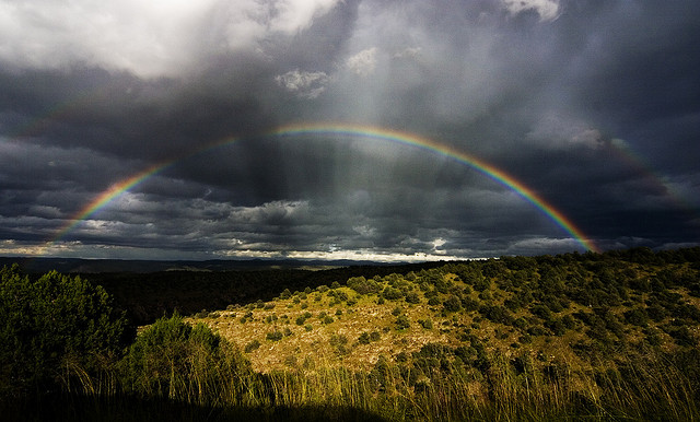
I don't have cool photos to post because my phone doesn't work well in the pouring rain, but I do have some cool graphs of the recorded water flows in the area via storm gauges. The information comes from the USGS water data website for New Mexico. Another great source to follow the storm has been Twitter, tag #nmwx (NM weather).
Here's the Santa Fe River (above the reservoirs). As can be seen the river has been running at a flow of 1.5 cubic feet per second (cfs) this Fall. The historical average for this time of year is 2.5cfs. Well, river discharge rocketed up to 170cfs last night and is at 140cfs as of Saturday morning. Up 100 fold. Think of the Rio Grande flowing through the gorge on the drive up to Taos. Near Embudo there the river has been running at around 250cfs the last several years. The Santa Fe Watershed approached that for a brief period last night.

Here's a view of the Rito Frijoles in Bandelier as a measure of the storm's intensity during the week. The Pajarito Plateau received rain in excess of 4" in places, half the year's average in a two day period. The canyon flashed from less than 1cfs to 1,000cfs. Four times the general flow of the Rio Grande near Embudo. That and the crests in the graph below are why Bandelier was closed yesterday and today.

A couple of images of just what 1,000cfs looks like in one of our little ritos, from the Bandelier Natl Monument Facebook page:
 |
| The Rito Frijoles near the visitors' center - Friday morning, Sep. 13, 2013 |
 |
| The Frijoles wanders into visitor parking and the picnic area - Friday morning, Sep 13, 2013 |
And here's a view of what the Rio Grande looked like after all the arroyos and ritos and rios emptied their cargo into the mother drainage. From 250cfs to 9,000cfs yesterday near San Felipe. This is below the Cochiti dam. In other words, the pulse of water would have been much higher were not for the catchment below Santa Fe. A section of the Pecos River down near Roswell was gauged in excess of 30,000cfs on Wednesday morning. The highest measured flow on the Pecos since the 1930s. Now that, is no joke people.

Related Posts:
- Frijoles Canyon in Recovery
- Bandelier National Monument and Lummis Canyon
- Santa Fe's Arroyos
I was wondering whether you were completely cut off from trails or not, and what would be the general effect on the zeitgeist up there if you were.
ReplyDeleteExcept for being tired of driving in it I'm enjoying the historiocity of it all and the respite from my droughted despair, but traffic in Abq when it's raining is historically perilous. After so many days without sunshine there's a kind of collective inability to be cool, then it rains. Imagine a hen house right when someone says the fox is coming, or something.
The trails got chewed up some, the arroyos have morphed into an entirely different state. I'm keenly aware that there are a lot of folks who didn't get off so light, but there is some fascination and wonder to be had, witnessing the things around you seemingly so permanent and anchored, re-arranged and re-formed in such a short period of time.
ReplyDelete