Showing posts with label Bandelier. Show all posts

Wednesday, December 26, 2018

South Mesa - Bandelier National Monument

The climb to the rim from Frijoles
The snow and cold may have finally arrived this morning. Not the case the previous two weeks however which provided optimal time to hit the difficult to reach trails. My favorite, and in my opinion the most underrated trails in the area, are at Bandelier.

I generally sneak in the back at Ponderosa campground. This is because I'm cheap when getting out for a run and don't care to fork-up the $25 gate fee. However I hadn't been out in the canyons for some time and Ponderosa and upper Frijoles were nuked by the Las Conchas fire and after repeat visits it can be bleak. The visitor's center and south mesa are still forested and serene so I hit it up last weekend while still free of ice and snow.

I intended to run out to the rim of Alamo Canyon, but didn't bring a map with me and made a fateful left turn that instead brought me out toward the Rio Grande canyon. Still beautiful, and new trails are always a fun adventure, but the ups and downs of fording the easy to navigate Lummis canyon were missed as was the awe of staring down into Alamo (800ft).

On the trail there was a single pair of hiking tracks which ceased after a couple miles. Still lots of tracks though all were wildlife (!), primarily deer and coyote. Saw an anthill made almost entirely of quartz crystals which fascinated me enough for a closer inspection. On a couple of rest stops to tie my shoe I was astonished to find that the mesa that evening was soundless. Without sound. I could stand there and look around at mountains and canyons and sunset and though craning my neck a bit there was not the smallest mote of movement or sound. After 15-20sec this odd absence would actually begin to bother me and I'd run on, stopping later to confirm that it was not a trick of the imagination. The Caja del Rio drew fairly close, maybe two miles direct, however the yawning Rio Grande canyon loomed below and between. Seems the trail likely descends a break in the mesa down to water's edge at some distant point. At my turn around (45min) the canyon had aligned with my line-of-sight and stretched far to the west with a glint of the pool at Cochiti dam reflecting sparks of white with the fading sun.

The Sandia uplift and Rio Grande canyon at center. Does not convey how sharp this view looks in person.

Snow on the San Miguels, juniper, cloud, and sunset
Note (12/26): The Monument is closed during the current government shutdown. I'd imagine there's access at Ponderosa and Frey Mesa. Perhaps Upper Frijoles off FR 289. The current snowstorm may make this a moot point for the next several days in any case.

Trail map, lower Alamo Trail: Bandelier Natl Mnmt < https://www.strava.com/activities/2021098426 >

Related Posts:
 - Bandelier Celebrates 99 Years (Feb 2015)
 - Bandelier and Lummis Canyon (Apr 2012)
 - Frijoles Canyon in Recovery (Apr 2012)


Sunday, February 15, 2015

Bandelier Celebrates its 99th Year

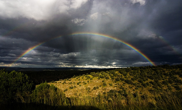
August storm
Wednesday was the 99th anniversary of the Bandelier National Monument - signed into existence on February 11, 1916, by President Woodrow Wilson. 33,000 protected acres on the Pajarito Plateau, over 70mi of trails, and it sits right in our backyard. Entry fees to the Monument are waived for the weekend (including Mon.) in celebration of the anniversary so Casa Dirt is jumping into action for an afternoon visit.

Rangers and personnel at the Monument regularly update the Bandelier Facebook page with magnificent photos of the Mesa, Frijoles Canyon, the San Miguel mountains to the south, and all the marvelous animal and plant life that fill the canyons. An absolute treasure. A small collection of photos from the last year:

Box elders


Related Posts:
 - Bandelier Natl Monument and Lummis Canyon
 - Frijoles Canyon in Recovery - Bandelier
 - Los Alamos - How Physicists Once Cleared a Ski Hill


Saturday, September 14, 2013

RAIN! - New Mexico River Levels Spike Upwards of 30 Times Average Flows

Lots of rain in New Mexico this week. How much? So much I can weed my yard without a trowel. A really cool novelty. Seriously though, it's so much rain that just about every drainage, rivulet, rito, creek, and river were bursting at the seams. Yay rain!

I don't have cool photos to post because my phone doesn't work well in the pouring rain, but I do have some cool graphs of the recorded water flows in the area via storm gauges. The information comes from the USGS water data website for New Mexico. Another great source to follow the storm has been Twitter, tag #nmwx (NM weather).

Here's the Santa Fe River (above the reservoirs). As can be seen the river has been running at a flow of 1.5 cubic feet per second (cfs) this Fall. The historical average for this time of year is 2.5cfs. Well, river discharge rocketed up to 170cfs last night and is at 140cfs as of Saturday morning. Up 100 fold. Think of the Rio Grande flowing through the gorge on the drive up to Taos. Near Embudo there the river has been running at around 250cfs the last several years. The Santa Fe Watershed approached that for a brief period last night.


Here's a view of the Rito Frijoles in Bandelier as a measure of the storm's intensity during the week. The Pajarito Plateau received rain in excess of 4" in places, half the year's average in a two day period. The canyon flashed from less than 1cfs to 1,000cfs. Four times the general flow of the Rio Grande near Embudo. That and the crests in the graph below are why Bandelier was closed yesterday and today.


A couple of images of just what 1,000cfs looks like in one of our little ritos, from the Bandelier Natl Monument Facebook page:

The Rito Frijoles near the visitors' center - Friday morning,  Sep. 13, 2013

The Frijoles wanders into visitor parking and the picnic area - Friday morning, Sep 13, 2013

And here's a view of what the Rio Grande looked like after all the arroyos and ritos and rios emptied their cargo into the mother drainage. From 250cfs to 9,000cfs yesterday near San Felipe. This is below the Cochiti dam. In other words, the pulse of water would have been much higher were not for the catchment below Santa Fe. A section of the Pecos River down near Roswell was gauged in excess of 30,000cfs on Wednesday morning. The highest measured flow on the Pecos since the 1930s. Now that, is no joke people.


Related Posts:
  - Frijoles Canyon in Recovery
  - Bandelier National Monument and Lummis Canyon
  - Santa Fe's Arroyos


Tuesday, June 4, 2013

Valles Caldera Marathon Cancelled due to Fire

Fire lines as of Monday 6/3 (click to enlarge)
Use nmfireinfo.com for current updates 
We heard early yesterday that this weekend's marathon and other Run the Caldera events would need to be postponed in light of the active Thompson Fire burning near the course. Turns out the need to cancel all race events was announced Sunday via the race Facebook page. The growing fire had expanded through Redondo Canyon and impaired the course as well as guaranteed that runners and race support would likely interfere with any fire management operations in the area.

I'd advise using the Facebook page to follow further updates, possible race re-scheduling, and the situation on the possible refund of fees or maybe entries into next year's event? I imagine they'll work this last part out but it's entirely possible that the race directors have spent much of their budget with the race only days away.

A real shame about both the re-visit of fire to the Caldera in our ongoing drought, and the cancellation of a gorgeous trail run that was beginning to pick up a growing field of runners.

Update: 
 In-person photos from of the Thompson Ridge Fire, courtesy of Jemez' Steve Pero here.

Update II:
Additionally, it looks like the Forest Service is shutting access to the Pecos Wilderness at least until resources are less strained from the Tres Lagunas Fire burning there. It sounds as though access could re-open if the fires come under control. The Jemez Ranger District (which includes Bandelier) has announced it is moving to Stage 2 fire restrictions, just one step below total closure. The Espanola Ranger District (Santa Fe NF) is currently under Stage1 fire restrictions.

Related Posts:
  - Run the Caldera 2012
  - NM Trail Racing Calendar
  - Los Conchas Fire 2011


View Valles Caldera Trail Marathon - New Mexico in a larger map


Friday, April 13, 2012

Frijoles Canyon in Recovery - Bandelier National Monument

Apparently the trails into the Bandelier backcountry are now open (with the exception of Falls Trail below Upper Falls due to a bridge washout). Los Alamos' Blake Wood toured Frijoles Canyon and the South Mesa last weekend to check out the damage from last year's fire and flooding. He photographed the somewhat frightening new landscape of the Frijoles Loop Trail (below).

The trail through Frijoles itself is mostly gone and the creekbed has been scoured several feet deeper in places. At least one location is blocked with enough debris to be only just passable. The section of canyon near the Visitor's Center appears to have been largely spared (from fire damage), but up canyon (6mi) near Upper Crossing the damage from fire and flooding is nearly total. Devastating in scope to the casual hiker or trail-runner, but perhaps a not-so-gentle reminder of the dual nature of both forests and canyons in particular. Forests burn and canyons flood.

All pictures courtesy of Blake Wood, thanks a bunch Blake. View the full album and comments here.

Forest burn at the Ponderosa Campground (Junction of 501 and Hwy 4)

The view up-canyon (toward the Valles Caldera) from the north switchbacks

The view looking south across Frijoles canyon. Pretty much everything is crispy

The Upper Crossing of Frijoles Canyon - once a beautiful piece of green forest floor with a clear creek running through. Pretty much obliterated at the moment. Hard to look at this one actually.

Looking back - the view of Frijoles from the south mesa rim. A bit of green toward Highway 4

On the south mesa. Lots of torched ponderosa

Blake reported that he saw evidence of previously hidden ruins and artifacts (shown here) uncovered by the blaze.

Descending back into Frijoles toward the Visitor's Center. Looks a lot better at this point in the canyon. You can see a bit of the cliff dwellings and pathways down on the left.

Climbing back up canyon, the looks of things aren't too bad near the Visitor's Center although the trail is mostly gone as are all the bridges.

Major debris pile built up against some of the un-burned tree stands. Gives an idea of the volume of water that came through the canyon with all the vegetation stripped away.

A new narrows along the canyon. This didn't use to be there, now it's an alarming big feature.

A view of the expanded creekbed. It used to flow in a fairly narrow settled-in channel. One can also view the scouring that has taken place - draw a visual line from just below the base of the tree to the cliff face.

More scouring through a tight section. There used to be an obvious and well-worn trail through here. Now only creek.


Old man pondy at the end of the line. I'd imagine there's several thousand acres of these fellas but this guy settled down over a piece of the trail. This looks to be near the F-Campground area.

A hollowed tree flagged by Rangers as a likely wind hazard

Nearing the Upper Crossing once again and the hike out. This area is just crushed. Hopefully the grasses and shrubs will hurry back and set some anchors for the rest of the area to stabilize. Careful hiking/running through these parts if you venture out to see things for yourself.


View Frijoles Canyon - Bandelier, NM in a larger map


Tuesday, April 10, 2012

Bandelier National Monument and Lummis Canyon


Adolph Bandelier c. 1880 - courtesy Museum of NM
Local historian Mark Simmons penned a terrific write-up of area icon and archeologist Adolph Bandelier in his most recent column in the Santa Fe New Mexican. Bandelier is a New Mexico figure I have a lot of admiration for if only because of my many wanderings through the canyons and mesa tops of his namesake at Bandelier National Monument. Even in the wonderland of northern New Mexico, the canyons of Bandelier are a special place to visit. As usual, Simmons frames a compelling historical profile that is worth a read if you have a few minutes to spare.

Bandelier came to New Mexico to survey and document many of the area's living pueblos at the turn of the century, but was eventually drawn to the ruins among the canyons of Los Alamitos upriver from Cochiti, proclaiming it to be 'the grandest thing I ever saw'. Simmons' write-up includes a bit about the archeologist's chance meeting and subsequent friendship with another New Mexico luminary, photographer Charles Lummis. Of their chance meeting, Bandelier writes:
"One day in a New Mexico sandstorm, a bronzed, middle-aged man, dusty but unweary from his 65-mile tramp from Zuni, walked into my solitary camp at Los Alamitos. Within the afternoon, I knew that here was the most extraordinary mind I had ever met."
Charles F. Lummis - courtesy of braunlibrary
Lummis was to travel extensively through the western Americas, spending a number of years in northern New Mexico, and later in his career he personally counseled President Teddy Roosevelt on the affairs of the Native Peoples of the western United States, acting as a staunch advocate for their cause. Together, Bandelier and Lummis archived and photographed much of the remaining artifacts and cliff dwellings of the people that once settled in and around the area of Frijoles Canyon. 

Established as National Monument in 1916, it was Bandelier's name selected by the Park Service to represent the area's cultural treasure in honor of the body of work the two men put together. Lummis' name adorns the magnificent canyon that stretches just west of Frijoles and Alamos canyons inside the Monument boundaries. The canyon's elevation profile dips 700ft from rim-to-floor. A spectacular sight and a trail obstacle with few rivals. 

There's a fairly extensive network of trails through Bandelier Monument that cross the mesas and send the canyons. The origins of some may be as old as the ancient cliff dwellings themselves. The loop through Frijoles Canyon (16+mi) might be the best trail run in northern New Mexico in my opinion. At the present time much of the backcountry trail network is closed due to the catastrophic damage from last summer's Las Conchas Fire. When the restoration work begins to fall into place and the trails open to the public once again it is well worth the time to run out Frijoles or venture out to Lummis Canyon and the Stone Lions beyond.

Frijoles Canyon looking west (c. 2008)  - courtesy of mywisconsinspace.com
Stone Lions, Bandelier Natl Mon. - HDD (Aug, 2009)


View Frijoles Canyon - Bandelier, NM in a larger map


LinkWithin

Related Posts Plugin for WordPress, Blogger...