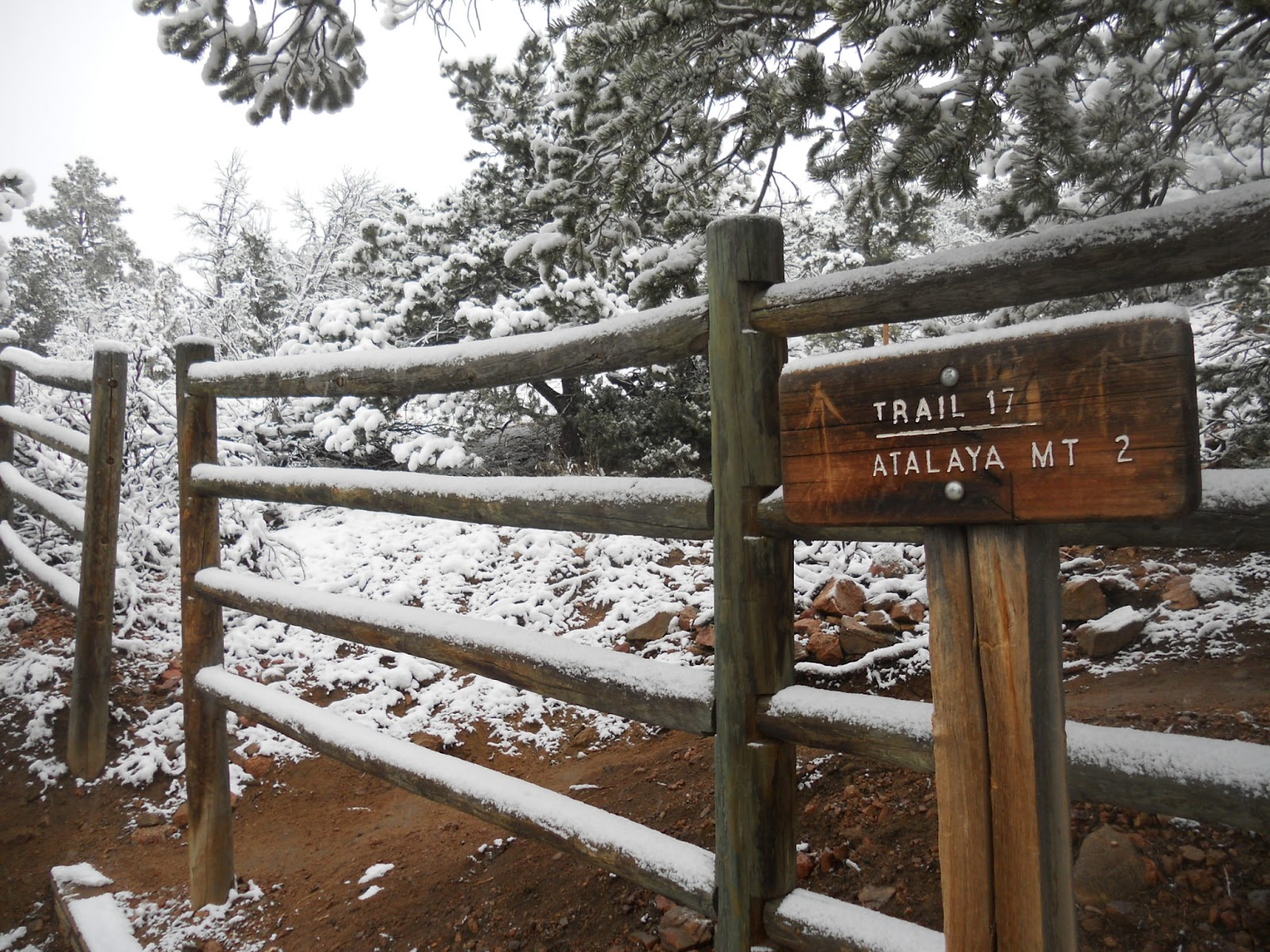
Showing posts with label Atalaya. Show all posts

Saturday, August 23, 2014

Atalaya Mountain in August

Atalaya Mountain - the 'watchtower' in archaic Spanish
MTB on Atalaya this morning. Clouds and a supervillain fog-bank up on the summit ridge were my prize. It's a fine morning when you can sip an IPA at breakfast and know you're good for it.

This morning's climb followed the blue route.A lot of obvious work on the trail from this month's maintenance crews. Bless those folks. Lots of volunteer trail days on the fall calendar.


View Atalaya Mountain Trail - Santa Fe, NM in a larger map

Related Posts:
 - Early Morning on Atalaya
 - Picacho Peak - Climbing the Ladder
 - Moon Mountain Trail

Friday, June 13, 2014

Moon Mountain Trail - Santa Fe, NM

Moon (l) and Sun (r) Mountains stand above the St. John's campus
In recognition of National Trails Day (Sat. June 8), I'm using this week to post write-ups and maps of a few lesser-known area trails. Unlike the more remote settings of the previously posted south-side trails, Moon Mountain and the route up to its summit sit hiding in plain sight among the nearby trail systems of the Santa Fe Foothills.

Moon mountain sits just south of Sun Mountain and just west of Atalaya but gets little love from hikers and trail runners. In fact, those two hikes are the most trafficked within city limits yet across the way on Moon one generally has the whole summit to themselves. One explanation may be that the hike to Moon is a bit longer (than Sun), but the obvious problem is that the trail is a lot less defined, un-marked, and requires a bit of adventure and route-finding to get where you're trying to go. I've never seen a map of the area before, printed or otherwise.

Picacho Peak as seen from the approach
Atalaya as seen from the Moon Summit
Moon summit - just a bunch of rocks until you put some shoes on them
Sun Mountain from the steep west descent off Moon
I prefer to hike/run Moon from the St. John's College trailhead, stretching out on the approach up the Arroyo Chamiso before motoring up the switchbacks to the summit. The trail up Moon's north face really doesn't switch all that much, meaning there's some steep direct climbing and the trail is often in various states of eroded wash-out. That said, roundtrip distance is only about 4mi without extenders.

One such extender is the convenient linkup with Sun Mountain, though combining the climbs can be a tough effort over the ~5mi distance. The trail runner's prize is a four summit linkup of Sun/Moon/Atalaya/and Picacho. Fun, but quite a bit tougher than it sounds.

Distance:  ~4mi loop
Max Elev:  8,085ft
Net Climbing:  ~900ft


View Moon Mountain - Santa Fe, NM in a larger map

Related Posts:
 - Apache Canyon Trail Loop
 - Eldorado Community Preserve Trails
 - Picacho Peak Summit

Friday, June 6, 2014

Apache Canyon Trail - Santa Fe, NM

dog and happy ponderosas above canyon
Saturday is National Trails Day. I'd thought I'd post a bunch of new trails, and as generally happens, I let the week get away from me. The first trail I thought I'd highlight is Apache Canyon.

Distance: ~6.3 miles loop
Max elev: 8,300ft
Net climbing: 1,100ft

A little known trail just north of town, but not well signed or mapped. To get there you drive up Old Santa Fe Trail several miles, through Canada de Los Alamos, stay on the road (now dirt) and you'll veer east and into the foothills eventually entering the NFS gate, now on FR 79. A few more miles of steep climbing and you'll find the not so well marked parking area and trailhead, look for parking blocks.

The trail starts and ends on unimproved forest roads. One charges off into the hills (east) for a mile-plus of pleasant windy roads, then you'll need to keep an eye out for some rock markers that will take you off trail and drop several hundred feet into the canyon. Lots of dramatic views, no people, a cool progression of tree and plant life as you descend, then later climb out of the canyon. Streams and wildlife on the canyon floor. The trailhead is at about 8,100', the canyon floor is at about 7,600' and there's a bit of climbing in between, so it's a tough loop but not as rough as running the steeps of Atalaya. When I was last there we casually ran it out in ~75min, although the climb out had us suffering.

Apache Canyon stream (courtesy of Mike Holdsworth)
A trail connector in the canyon bottom will take you up and east to Glorieta Baldy, which is maybe an additional 3-4mi one way. The ambitious might even stretch that route for a top-out on Thompson Peak. Most folks familiar with this trail will bike Glorieta Baldy from the south, then descend this section from the watchtower and make their way back to town once reaching the trailhead. There are also trail options to the north of the trailhead that tour back behind Atalaya and Sierra Pelada. Most are the adventure-type rather than picturesque-singletrack. Sadly I have no good photos of the trail or surrounding area, thwarted by high winds and snow when I was mapping this out in April. Perhaps this can add to the unknown mystique of this little gem.

Related Posts:
 - Glorieta Baldy
 - Eldorado Preserve Trails
 - Barbaria Trail Loop


View Apache Canyon Trail - Santa Fe, NM in a larger map


Wednesday, July 3, 2013

Climbing the Ladder on Picacho Peak

The pointy cap of Picacho
Picacho is one of two high trails remaining open during the current trail closures, the other being Atalaya. I can confirm this since a friend and I were out in the foothills early Saturday morning sewing up the switchbacks. And there are a lot of them.


Looking faded on the top
Picacho is the notable highpoint just to the north of Atalaya. It's got a ripper of a name and a distinctive silhouette, but it's also crazy steep. It's steep character does make for less crowded trails and some mighty fine view points. Unlike Atalaya to the south, Picacho offers more exposure along the climb. No ponderosa canopies or sheltered flat sections. So the views are tremendous if you're not hard-charging for a rest on top. Views down into the Santa Fe Watershed are especially lovely and dramatic. 

Right, so I hadn't been up this way in a while and we like to add variety to our outings so off (and up) we went. I don't run Picacho much and here's why:  It's steep as hell and it's an out-and-back. Two miles of un-relenting climbing above Santa Fe Canyon, followed by two miles of steep descent. Great views of Atalaya though, and if you have the time you can link them both up (think Dale Ball Buster). You may be training for a hill climb - say, La Luz - in which case the trail up Picacho is is tailor made just for you. If this is in fact the case, know that you can tack on an extra 2+ miles and 400ft of climbing by starting your run at the Upper Canyon Rd/Cerro Gordo Trailhead (think Dale Ball Buster). The direct ascent from Upper Canyon is the longest steepest percentage grade trail climb in Santa Fe.

Tough going, but open and accessible unlike many of our surrounding trails. Out and back on our route mapped below is just four miles (28min climb, 23min descent). Several variations are available at mapped junctions.


The north Atalaya ridge to the east, summit at right

Atalaya Peak looking south

Picacho summit stones with the Santa Fe Watershed at middle and the Sangres in the distance

Picacho:  Spanish for 'top, or summit; sharp point of anything'
Distance: 4mi roundtrip
Elevation at Upper Atalaya trailhead: 7450ft
Picacho Summit: 8577ft


View Picacho Peak - Santa Fe, NM in a larger map


Sunday, March 3, 2013

The Charms of Winter Trail Running

Sunrise along the Santa Fe River - Picacho Peak in outline

The shorter days can sometimes crush the motivation for getting out. Tights, hat, a pair of gloves and weekends are a solid defense for this insidious malady. Along with a few friends I've been diligently keeping the rust at bay with morning runs that canvass the foothills above town. The rewards of trail outings in the off-season are the near total solitude and the incredible beauty of snow and winter light.


Morning light on the Sangre de Cristos from Dorothy Stewart

Moon and sun mountains cast tall shadows toward the Sandias

Atalaya's north ridge with new snow - Sangres in the distance

Sending one of the steeper sections on the Atalaya Ridge - Hadji and his two wonder-dogs up ahead
Morning summit of Atalaya - views over the Rio Grande Valley of the Ortiz and Sandia Mountains

And a few gratuitous non-running images:

The snow covered Jemez from La Tierra - Caballo Peak partially obscured by cloud
Winter weather and snow descend on the Sangres before breakfast

Thompson Peak and snow-filled Valentine chutes at sunrise with morning storm clouds 

Thompson Peak at left from a closer vantage on Dale Ball trail, Hadji and Adam at center, Picacho Peak at right. 

Mini-me enjoying a run with Dad past a sunset so dazzling it obscured the photo

Related Posts & Trail Maps:
  - Atalaya Mountain
  - La Tierra Trails
  - Dorothy Stewart Trail


Sunday, February 10, 2013

Early Morning on the Atalaya Trails

Adam and Hadji at the crest


Distance:  5mi.roundtrip
Elevation Gain: 1,600ft
Summit:  9,121ft
Time:  37min up, 19min down

A quick summit of Atalaya yesterday morning before the storms came through. Plenty of snow along the north ridge leading down to Picacho. I was with friends Adam and Hadji who towed me up when I cracked after the first steep section. I made the second mistake of wearing an ultralight shoe, not so good on the ice and steeper descents. Didn't see a single hiker, so we had all the blue vistas to ourselves.


Summit views of the city to the west - Atalaya Mtn 830am


Views off the north ridge, north foothills and the Dale Ball Trail layout below

View of town on the upper descent. The Jemez beyond are washed out from the light contrasts.

Our route ascended the main trail from the Atalaya trailhead, orange at first then blue below. We descended along green then an unmarked section between Picacho and Atalaya on the return.


View Atalaya Mountain Trail - Santa Fe, NM in a larger map


Wednesday, April 4, 2012

Atalaya Mountain and Spring Snowstorms

sun mountain snow
St John's College and Sun Mountain and snow
Distance: 7mi roundtrip
Starting elev at St John's College TH: 7300ft
Atalaya Summit: 9121ft
Atalaya: (Sp) for 'Watchtower', which is badass in of itself

The three weeks of Spring weather that we had enjoyed of late was firmly pushed aside Monday by a terrific blast of winter. New Mexico is awesome. I might as well be living in Disneyland.

From the office desk I watched in wide-eyed silence as the gloom outside spread and grew dark and big gobs of snow finally began falling from the heavens. Given those circumstances there is really only one appropriate action to take  - and that's to race home, grab the running shoes (and hat and gloves), and dash off to the hills for an epic snow-trail run. And that's what I did.

Trees in bloom with spring snow

chamisa winter snow
Frosted chamisas along the arroyo
santa fe winter snow
Looking down valley from Wilderness Gate Rd

juniper winter snow
Snowy juniper

atalaya mountain winter snow
At the (national) forest gate - one mile in

My preference in running-trails when the weather socks-in is Atalaya. The gains in altitude amplify the snow and cloud for maximum effect. Not a lot of traffic out there Monday night unless you count the ponderosa and cedar. They looked as psyched as I was, pantomiming low sweeping tree-branch hi-fives to each other. 

atalaya mountain winter snow
The baby ponderosa grove at the third switchback

atalaya mountain winter snow
Spring running trail

ponderosa tree winter snow
Crazy hi-fiving ponderosa

santa fe foothills winter
The foothills in snow
santa fe foothills snow
Dry ledge with handy moss rocks

atalaya mountain winter snow
Atalaya finally comes into view

Near zero visibility at the top. I know there was a sunset out there somewhere, but the view of ridgelines receding into stormcloud was pretty impressive all the same. The weather picked up and I headed back. Descended in the dark. Didn't see a soul for 90min+, coming or going, on one of the best days on Atalaya we'll have all year.

atalaya mountain winter snow
Atalaya summit

atalaya mountain winter snow
South ridge of Atalaya in cloud (and sunset)

Somewhere Christmas-y and wonderful

national forest sign snow
Back at the trailhead

I've made the summit in 43min before. Add approximately 7min if your plans include hi-fiving trees, heckling the crows, and walking a few of the steeps.1hr+ for hikers (one-way)

A looped hike is possible off the north ridge down the saddle to Picacho Peak, then descending portions of the Dorothy Stewart Trail back to Camino Cruz Blanca or St. John's. Approximate mileage for this link-up is 8mi+.

Nearby Trails:

Monday, January 17, 2011

Barbaria Trail Loop - Santa Fe

I tried to parlay our crumby snow conditions into good biking conditions on Saturday.  I figured the trails I wanted to link up would be somewhat free of snow or would at least be hardpack.  I figured wrong, and it didn't help that I left the house a bit late (after 11am) and had to deal with mud as well.  Life can be a struggle sometimes. Didn't see anyone else on the trails until I was near St Johns, maybe because of the football games later in the day.

The backroads of Arroyo Hondo

Technical section - the Willows Gauntlet

The ride heads south on the RailTrail to Arroyo Hondo, looping east to Old Santa Fe Trail and Barbaria Rd, then back through the drainage behind Sun and Moon mountains to St. John's College, returning home along the Arroyo Chamiso.  A great loop with all types of terrain. I don't have a name for this link-up but Barbaria Loop seems to be an ok fit.

Steep section of the climb up Barbaria Hill
Gate to the Atalaya drainage and big-time bike wreckage

Bike and Nowhere Gate
I ran this out a few times last year when training for a spring marathon. It can be tough on foot especially in winter conditions, but by bike I took a thrashing. Went down hard a few times on the ice, broke my seat post, smashed my arm, started bonking a bit towards the end.  Recovered with grape Shasta and a car ride to Chama for some skiing where the snow is a bit nicer. Who's laughing now Barbaria?  I'll be back when the bike is repaired for a bit of unsettled business.

Distance: approx. 18-19mi
Time:  Took me 2+ hrs by bike in difficult conditions. Free of snow it's about 2hr10min. Might be more of an April-Dec type ride, but you never know if you never try. 

Arroyo singletrack
New crossing behind St Johns


View Barbaria Loop - 18 Miler in a larger map


Related Posts:
  - Las Campanas - SF Road Loop
  - Glorieta Baldy

LinkWithin

Related Posts Plugin for WordPress, Blogger...