Showing posts with label Foothills. Show all posts

Friday, October 17, 2014

Arroyo Washout

Two foot+ drop in the arroyo floor at the St Francis Dr. crossing
My weekend run was along the Arroyo Chamiso. I'd seen in passing that the arroyo channel was destroyed near the house and I wanted to tour the rest of the carnage. Storms like the one that produced this flood happen every couple years but they're always a source of awe and excitement.

Massive scouring and drops in some areas; other areas collecting the tons of displaced sand resulting in rises of several feet. Debris in trees at levels above shoulder-height. Amazing stuff.

On the return trip I stumbled on two young graffiti artists in the culvert of the Old Pecos Trail crossing. They called me sir. I critiqued their work and ran on. Good kids.


Storm debris at the bridge along Gail Ryba suggests the flood level was above the bridge deck

Heavy debris (entire chamisa bushes) wrapped on railroad pylons up to 6ft in height

Helpful sign along Gail Ryba:  Don't enter the arroyo when flooding
An up-arroyo property armored with willow and cottonwood plantings. Erosion minimal.
A recent Dia de los Muertos themed piece near the museums


Related Posts:
 - RAIN! - NM River Levels Spike 30x Avg Flows (2013)
 - Come Hell or High Water - Monsoon Season (2013)
 - Floods Ravage Bandelier and Cochiti Canyons (2011)
 - Santa Fe's Arroyo Systems

Saturday, August 23, 2014

Atalaya Mountain in August

Atalaya Mountain - the 'watchtower' in archaic Spanish
MTB on Atalaya this morning. Clouds and a supervillain fog-bank up on the summit ridge were my prize. It's a fine morning when you can sip an IPA at breakfast and know you're good for it.

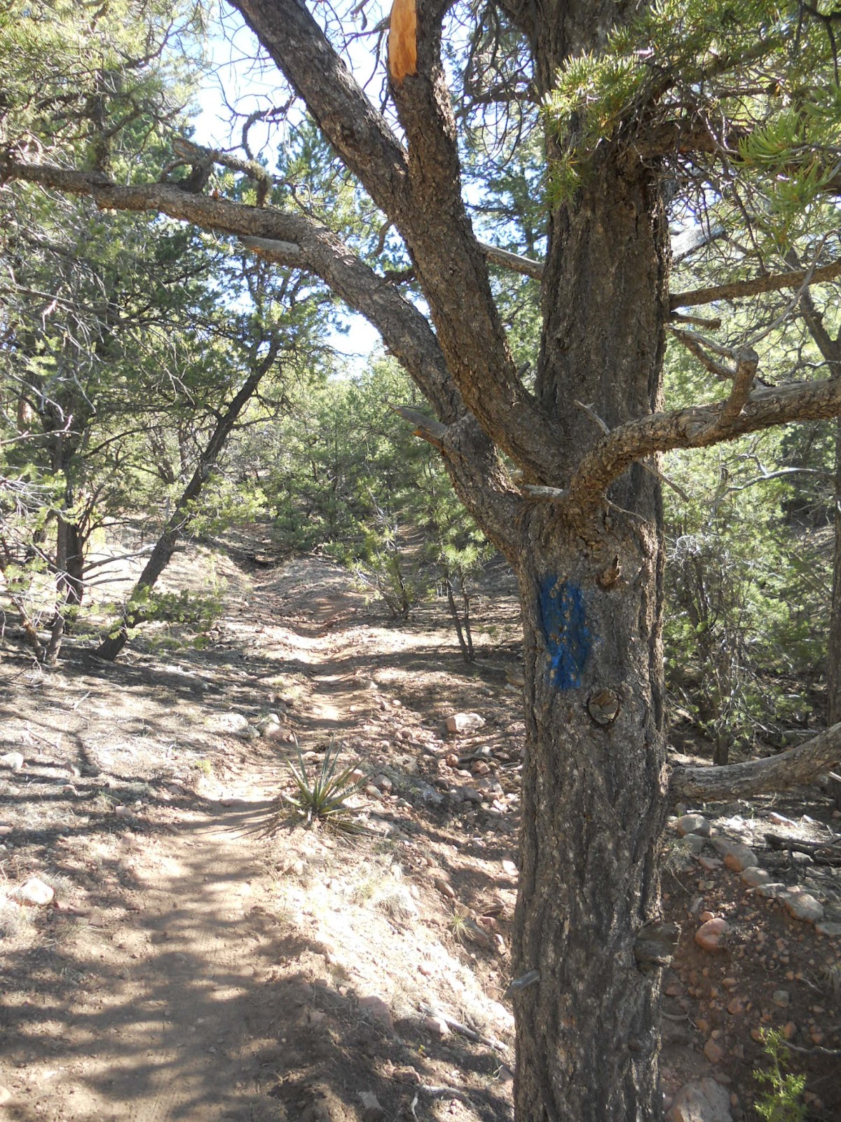
This morning's climb followed the blue route.A lot of obvious work on the trail from this month's maintenance crews. Bless those folks. Lots of volunteer trail days on the fall calendar.


View Atalaya Mountain Trail - Santa Fe, NM in a larger map

Related Posts:
 - Early Morning on Atalaya
 - Picacho Peak - Climbing the Ladder
 - Moon Mountain Trail

Friday, June 13, 2014

Moon Mountain Trail - Santa Fe, NM

Moon (l) and Sun (r) Mountains stand above the St. John's campus
In recognition of National Trails Day (Sat. June 8), I'm using this week to post write-ups and maps of a few lesser-known area trails. Unlike the more remote settings of the previously posted south-side trails, Moon Mountain and the route up to its summit sit hiding in plain sight among the nearby trail systems of the Santa Fe Foothills.

Moon mountain sits just south of Sun Mountain and just west of Atalaya but gets little love from hikers and trail runners. In fact, those two hikes are the most trafficked within city limits yet across the way on Moon one generally has the whole summit to themselves. One explanation may be that the hike to Moon is a bit longer (than Sun), but the obvious problem is that the trail is a lot less defined, un-marked, and requires a bit of adventure and route-finding to get where you're trying to go. I've never seen a map of the area before, printed or otherwise.

Picacho Peak as seen from the approach
Atalaya as seen from the Moon Summit
Moon summit - just a bunch of rocks until you put some shoes on them
Sun Mountain from the steep west descent off Moon
I prefer to hike/run Moon from the St. John's College trailhead, stretching out on the approach up the Arroyo Chamiso before motoring up the switchbacks to the summit. The trail up Moon's north face really doesn't switch all that much, meaning there's some steep direct climbing and the trail is often in various states of eroded wash-out. That said, roundtrip distance is only about 4mi without extenders.

One such extender is the convenient linkup with Sun Mountain, though combining the climbs can be a tough effort over the ~5mi distance. The trail runner's prize is a four summit linkup of Sun/Moon/Atalaya/and Picacho. Fun, but quite a bit tougher than it sounds.

Distance:  ~4mi loop
Max Elev:  8,085ft
Net Climbing:  ~900ft


View Moon Mountain - Santa Fe, NM in a larger map

Related Posts:
 - Apache Canyon Trail Loop
 - Eldorado Community Preserve Trails
 - Picacho Peak Summit

Friday, June 6, 2014

Apache Canyon Trail - Santa Fe, NM

dog and happy ponderosas above canyon
Saturday is National Trails Day. I'd thought I'd post a bunch of new trails, and as generally happens, I let the week get away from me. The first trail I thought I'd highlight is Apache Canyon.

Distance: ~6.3 miles loop
Max elev: 8,300ft
Net climbing: 1,100ft

A little known trail just north of town, but not well signed or mapped. To get there you drive up Old Santa Fe Trail several miles, through Canada de Los Alamos, stay on the road (now dirt) and you'll veer east and into the foothills eventually entering the NFS gate, now on FR 79. A few more miles of steep climbing and you'll find the not so well marked parking area and trailhead, look for parking blocks.

The trail starts and ends on unimproved forest roads. One charges off into the hills (east) for a mile-plus of pleasant windy roads, then you'll need to keep an eye out for some rock markers that will take you off trail and drop several hundred feet into the canyon. Lots of dramatic views, no people, a cool progression of tree and plant life as you descend, then later climb out of the canyon. Streams and wildlife on the canyon floor. The trailhead is at about 8,100', the canyon floor is at about 7,600' and there's a bit of climbing in between, so it's a tough loop but not as rough as running the steeps of Atalaya. When I was last there we casually ran it out in ~75min, although the climb out had us suffering.

Apache Canyon stream (courtesy of Mike Holdsworth)
A trail connector in the canyon bottom will take you up and east to Glorieta Baldy, which is maybe an additional 3-4mi one way. The ambitious might even stretch that route for a top-out on Thompson Peak. Most folks familiar with this trail will bike Glorieta Baldy from the south, then descend this section from the watchtower and make their way back to town once reaching the trailhead. There are also trail options to the north of the trailhead that tour back behind Atalaya and Sierra Pelada. Most are the adventure-type rather than picturesque-singletrack. Sadly I have no good photos of the trail or surrounding area, thwarted by high winds and snow when I was mapping this out in April. Perhaps this can add to the unknown mystique of this little gem.

Related Posts:
 - Glorieta Baldy
 - Eldorado Preserve Trails
 - Barbaria Trail Loop


View Apache Canyon Trail - Santa Fe, NM in a larger map


Wednesday, July 3, 2013

Climbing the Ladder on Picacho Peak

The pointy cap of Picacho
Picacho is one of two high trails remaining open during the current trail closures, the other being Atalaya. I can confirm this since a friend and I were out in the foothills early Saturday morning sewing up the switchbacks. And there are a lot of them.


Looking faded on the top
Picacho is the notable highpoint just to the north of Atalaya. It's got a ripper of a name and a distinctive silhouette, but it's also crazy steep. It's steep character does make for less crowded trails and some mighty fine view points. Unlike Atalaya to the south, Picacho offers more exposure along the climb. No ponderosa canopies or sheltered flat sections. So the views are tremendous if you're not hard-charging for a rest on top. Views down into the Santa Fe Watershed are especially lovely and dramatic. 

Right, so I hadn't been up this way in a while and we like to add variety to our outings so off (and up) we went. I don't run Picacho much and here's why:  It's steep as hell and it's an out-and-back. Two miles of un-relenting climbing above Santa Fe Canyon, followed by two miles of steep descent. Great views of Atalaya though, and if you have the time you can link them both up (think Dale Ball Buster). You may be training for a hill climb - say, La Luz - in which case the trail up Picacho is is tailor made just for you. If this is in fact the case, know that you can tack on an extra 2+ miles and 400ft of climbing by starting your run at the Upper Canyon Rd/Cerro Gordo Trailhead (think Dale Ball Buster). The direct ascent from Upper Canyon is the longest steepest percentage grade trail climb in Santa Fe.

Tough going, but open and accessible unlike many of our surrounding trails. Out and back on our route mapped below is just four miles (28min climb, 23min descent). Several variations are available at mapped junctions.


The north Atalaya ridge to the east, summit at right

Atalaya Peak looking south

Picacho summit stones with the Santa Fe Watershed at middle and the Sangres in the distance

Picacho:  Spanish for 'top, or summit; sharp point of anything'
Distance: 4mi roundtrip
Elevation at Upper Atalaya trailhead: 7450ft
Picacho Summit: 8577ft


View Picacho Peak - Santa Fe, NM in a larger map


Monday, April 22, 2013

Cycling Dale Ball and Dorothy Stewart

The new maps on Dale Ball South!
Out in the foothills on Saturday, saw that the Forest Service had signed a few of the intersections near Atalaya with these cool new maps. Signs and maps! Progress has truly arrived in Santa Fe. No, but I'd love to see several more of these on the trails. I tend to know where I'm going but I don't get the feeling that a lot of other people do.

As a bonus, this map was posted not just at the first trail junction - where TR 170 splits off to Atalaya - but at the next two junctions as well. A sincere hi-five to whomever headed this project. One small omission is notable however; the map details Talaya Hill Open Space but Talaya Hill itself isn't marked. I mean, we've got Castle Rock in there but not Talaya? Maybe Talaya is a brooding and mysterious type of character. Castle Rock must be the extrovert.
Talaya Hill Open Space minus Talaya Hill
(click through for better detail)

On a side note, it's worth a mention that Forest TR 170 is the easier, less steep approach to both Dorothy Stewart and Atalaya. If you want to get your bike up onto Dorothy Stewart (or lower Atalaya) without the extended sections of hike-a-bike, this is your route. Still a technical ride but much more reasonable than the climb from Talaya Hill or the direct route from the Camino Cruz Blanca T/H.

The GPS map doesn't clearly show the air you can soar through off some of the rollers down on lower Dorothy Stewart. Nor does it show the collisions with off-trail trees on upper Dorothy Stewart. More of the former less of the latter for a pleasant ride.

Dale Ball South and morning sun

Some old dude rockin' his new wind vest (toasty warm)
Nearby Trails:
 - Atalaya Mountain Trail
 - Sun Mountain Trail
 - East Hills Arroyo - St John's College


View Dorothy Stewart Ridgeline Trail - Santa Fe, NM in a larger map

 - TR 170 in yellow
 - Dorothy Stewart Loop in blue
 - Talaya Hill (top-left flag), 7,439ft


Sunday, February 10, 2013

Early Morning on the Atalaya Trails

Adam and Hadji at the crest


Distance:  5mi.roundtrip
Elevation Gain: 1,600ft
Summit:  9,121ft
Time:  37min up, 19min down

A quick summit of Atalaya yesterday morning before the storms came through. Plenty of snow along the north ridge leading down to Picacho. I was with friends Adam and Hadji who towed me up when I cracked after the first steep section. I made the second mistake of wearing an ultralight shoe, not so good on the ice and steeper descents. Didn't see a single hiker, so we had all the blue vistas to ourselves.


Summit views of the city to the west - Atalaya Mtn 830am


Views off the north ridge, north foothills and the Dale Ball Trail layout below

View of town on the upper descent. The Jemez beyond are washed out from the light contrasts.

Our route ascended the main trail from the Atalaya trailhead, orange at first then blue below. We descended along green then an unmarked section between Picacho and Atalaya on the return.


View Atalaya Mountain Trail - Santa Fe, NM in a larger map


Wednesday, November 28, 2012

Sun Mountain Loop - Santa Fe, NM


Distance: 5.5mi roundtrip
Starting Elevation: 7,000ft
Summit Elevation: 7,920ft
Total Elev Gain: 1,400ft
Run time: 65min

Earlier this summer the city finally formalized hiking access to Sun Mountain. The trails have been there as long as I can remember, there was just never any central trailhead. Folks would set out from St. John's College or other informal waypoints and, as with many of the older trails around town, you just had to know from memory that a trail spur started behind that fence post, or that pinon, or up the driveway 40ft then veer left. New homes in the area over the last twenty five years have also closed off some sections of north-south trail that used to connect to the Arroyo Chamisos. In a fairly publicized development dispute a couple years ago, the Save Sun Mountain campaign came about, and donated money was rounded up to buy the last parcel of undeveloped land off the mountain's west slope which was then placed in trust for public access. The trailhead was mostly built out last summer, then left fenced off and unopened from what I could only guess was a reaction to the dangers of an incredibly destructive fire-season. The city finally opened it all up earlier this summer and it now gets a fair amount of traffic, particularly before sunset.

The new public easement and trailhead

I've yet to see a map of the existing trails on and around the mountain, particularly off the northside of Sun Mountain where access to St. John's College is a mess of unimproved trail, cairns to nowhere, spiderwebs of bullshit, and deadend ravines and drainages. The one well defined thru-trail heads away from St. John's, into the saddle with Moon Mountain, then east into the Arroyo Chamisos at the foot of Atalaya. It's marked decently with cairns but can be difficult to follow at dusk.

From the summit: Moon mountain at right, rising moon at top left, south Atalaya ridge at center

After poking around these these trails and hills over the last few weeks I finally mapped out the best existing loop during a run with Hoskisson over the Thanksgiving weekend. Beginning from Museum Hill the full loop is just short of six miles, the section of climbing is a bit less than one mile (trailhead-to-summit) with about 800ft of climbing.

We made the summit in 28min from the Cristobal Lane trailhead (Note: the area at Conejo Rd and Calle de Leon is fire lane access only. Neighbors have asked me to make clear this is not a trailhead nor open to parking; use the Cristobal or Cam. Corrales trailheads), running the loop counter-clockwise. 65min to run out the full loop. Sections of the climb are scrambling-steep and not rideable by bike.

Nearby Trails:
  - Atalaya Mountain
  - Dorothy Stewart Ridgeline
  - Upper Arroyo Chamisos &  East Foothill Trails
  - Moon Mountain


View Sun Mountain Trail Loop - Santa Fe, NM in a larger map


Wednesday, June 6, 2012

The La Piedra Trail - Dale Ball

Dale Ball Connector
La Piedra Trail - Descending the zipline
Among the many new trail projects around Santa Fe in the last year, a real keystone to the area's bike trails has been developing east of town - the La Piedra Connector Trail. La Piedra will tie together the national class Dale Ball Trails system in Santa Fe's east hills with the older and much more extensive Winsor Trail system that stretches north and east of town through the Santa Fe National Forest with access to the Pecos Wilderness and places north - like Penasco. An ambitious Santa Fean can now thru-hike (or run) 40+ miles across the Sangres to the Santa Barbara campground without crossing a road. I love to think about that. Specifically, the Connector will link the north loop of Dale Ball (north of the Sierra del Norte trailhead) with the Little Tesuque Creek Trail 1.5 miles to the north. Little Tesuque links to Winsor through a steep climb north to the Burn Trail.

Santa Fe Conservation Trust
The La Piedra Connector is the work of the Santa Fe Conservation Trust, its executive director Charlie O'Leary, and the SFCT's volunteer affiliate the Trails Alliance of Santa Fe. Funding came in from local contributors (you can be one too!), proceeds from the Banff Film Festival screenings this spring, as well as proceeds from the La Tierra Torture bike races. Charlie mentioned that a five-figure grant came in from a California Foundation whose trustee held fond memories of running in the hills above Santa Fe, which is awesome. The Trust was founded in 1993 by conservationist scion Stewart Udall, and is primarily responsible for negotiating the public easements and legal work required in setting aside privately owned land parcels for non-developed use in perpetuity. SFCT negotiated public/private easements for the initial construction of the Dale Ball Trails in the 90's, early improvements to the Rail Trail, as well as development of the Arroyo Hondo Preserve, the Cerrillos Hills Preserve, La Tierra Trails, and most recently - the Galisteo Basin Preserve.

Trials Alliance Santa Fe
My crew from the Trails Alliance of Santa Fe. At far left are Lynn and Charlie.
Trials Alliance Santa Fe
Some instruction on how to use our lobotomizers for good, not evil
The Dale Ball Trails have become a fixture in town, and the model for all the miles of recreation trails that have been built since. In fact it's difficult to remember when none of this was here. Being a native to the area I can tell you that back when I left for school, Santa Fe had only arroyos, Atalaya, and Winsor. The parcel of land that the Connector now runs through has long been eyed as the finishing piece of the iconic trail system. According to O'Leary, the landowner that placed the parcel in trust knew this and it was the primary motivator for doing so. The new trail crosses through the beginnings of the La Piedra arroyo drainage which it takes its name from.

Dale Ball Connector
On the trek in - making trail sons!
Working with the SF Trails Alliance, SFCT designed and mapped out a workable trail through the easement boundaries and contracted a team out of Albuquerque to conduct the initial trail cut. Work was originally planned to have begun in October but was pushed off until this spring when local volunteers including entire trail maintenance teams put together by the Santa Fe Fat TireSociety and REI Santa Fe knocked out much of the detail work by hand, including armoring switchbacks and corners, erosion controls, trail sloping, etc. I got out there and helped too. Myself and another Santa Fe badass named Lynn cleared out a load of deadfall and fixed up other drainage issues on the westside gully before the up-and-over into Little Tesuque. When you ride/run through there and see how awesome it is - you know who to mentally high-five.

The land parcel is limited in size, and as designed the Connector has a lot of tight, technical switchbacks in a steep descent down into the Little Tesuque drainage east of Bishop's Lodge. Thirty-three switchbacks by my count including a few more in the climb preceding the descent. A group of us ran it out the day after our trail maintenance work and it was fantastic. A terrific addition to the growing trail network.

Dale Ball Connector
Out with friends the day after - crushing the switchbacks

Dale Ball Connector
And down, and down, and further still - down

Burn Trail Santa Fe
Blue blazes trace the way up the Burn Trail

Burn Trail Santa Fe
At the fence-line to Winsor and beyond

Burn Trail Santa Fe
At the Juan Trail/Burn Trail highpoint - Tesuque Peak in view
Related Links


View Dale Ball Trail System - Santa Fe, NM in a larger map


Wednesday, April 4, 2012

Atalaya Mountain and Spring Snowstorms

sun mountain snow
St John's College and Sun Mountain and snow
Distance: 7mi roundtrip
Starting elev at St John's College TH: 7300ft
Atalaya Summit: 9121ft
Atalaya: (Sp) for 'Watchtower', which is badass in of itself

The three weeks of Spring weather that we had enjoyed of late was firmly pushed aside Monday by a terrific blast of winter. New Mexico is awesome. I might as well be living in Disneyland.

From the office desk I watched in wide-eyed silence as the gloom outside spread and grew dark and big gobs of snow finally began falling from the heavens. Given those circumstances there is really only one appropriate action to take  - and that's to race home, grab the running shoes (and hat and gloves), and dash off to the hills for an epic snow-trail run. And that's what I did.

Trees in bloom with spring snow

chamisa winter snow
Frosted chamisas along the arroyo
santa fe winter snow
Looking down valley from Wilderness Gate Rd

juniper winter snow
Snowy juniper

atalaya mountain winter snow
At the (national) forest gate - one mile in

My preference in running-trails when the weather socks-in is Atalaya. The gains in altitude amplify the snow and cloud for maximum effect. Not a lot of traffic out there Monday night unless you count the ponderosa and cedar. They looked as psyched as I was, pantomiming low sweeping tree-branch hi-fives to each other. 

atalaya mountain winter snow
The baby ponderosa grove at the third switchback

atalaya mountain winter snow
Spring running trail

ponderosa tree winter snow
Crazy hi-fiving ponderosa

santa fe foothills winter
The foothills in snow
santa fe foothills snow
Dry ledge with handy moss rocks

atalaya mountain winter snow
Atalaya finally comes into view

Near zero visibility at the top. I know there was a sunset out there somewhere, but the view of ridgelines receding into stormcloud was pretty impressive all the same. The weather picked up and I headed back. Descended in the dark. Didn't see a soul for 90min+, coming or going, on one of the best days on Atalaya we'll have all year.

atalaya mountain winter snow
Atalaya summit

atalaya mountain winter snow
South ridge of Atalaya in cloud (and sunset)

Somewhere Christmas-y and wonderful

national forest sign snow
Back at the trailhead

I've made the summit in 43min before. Add approximately 7min if your plans include hi-fiving trees, heckling the crows, and walking a few of the steeps.1hr+ for hikers (one-way)

A looped hike is possible off the north ridge down the saddle to Picacho Peak, then descending portions of the Dorothy Stewart Trail back to Camino Cruz Blanca or St. John's. Approximate mileage for this link-up is 8mi+.

Nearby Trails:

LinkWithin

Related Posts Plugin for WordPress, Blogger...